Thursday, May 28, 2009

Day 34 (May 23): Gualala, CA-Lagunitas, CA -- 89.7 miles biked


(Written from Bad Ass Coffee, Santa Cruz, CA)

Miles biked: 89.7 (1,253.4 overall)

Time on bike: 7 hours, 20 minutes, 32 seconds

Maximum speed: 35.7 mph

Roads taken: SR-1 South, Pt. Reyes Petaluma Road, Platform Bridge Road, Sir Francis Drake Boulevard, Marin Trail bike path.

Places stopped: Fort Ross (for an oatmeal, bread and tea breakfast, and to prepare for the killer stretch), Jenner (to catch my breath and eat a banana), Valley Ford (for a much-needed lunch break: PB&J sandwich, cookie, gorp), Samuel B. Taylor State Park (for the night).

I thought about making this an easy day, considering the three consecutive difficult days I'd had.

But, of course, there was a problem.

There was a campsite in Bodega Bay, but that was only about 45.7 miles down SR-1. With an early start, I could reach that before 1. And then what? I love Bodega Bay as much as the next guy, folks, but it doesn't deserve an entire afternoon. Not when the smell of San Fran is in the air.

The next campsite, however, was another 45 miles down 1.

Damn, I thought, how can there not be a single spot in-between?

But my decision was made. I'd suck it up, "man-up," whatever you want to call it, and suffer through another long day so that I could relax, finally, in the days after it.

I didn't get the earliest start, not getting on the bike until just before 8, and the going wasn't fast either. But after what seemed like 6 hours, I made it to the tiny, tiny town of Fort Ross and stopped for a much-needed breakfast, which I hoped would also serve as a Red Bull.

That's because the toughest, most crazy stretch of my day was in front of me -- 13 miles between Fort Ross and Jenner of biking 300 to 400 feet above the ocean on a road with narrow shoulders and, at times, no guard rails.

To add to the challenge, it was foggy (when is it not around here? Answer: never). I even turned my front light on as a precaution. And then I headed up my first hill...

And I actually, somewhat, enjoyed myself. Sure, I did a whole bunch of climbing. And, sure, a bad turn to the right could easily send me off the bluff and down into the cold, unwelcoming Pacific far below.

But the riding was cool, almost mystic.

The fog obscured my view to the left, where large, vast, green hills loomed. At times, I even felt like I was hiking on an early morning in New Hampshire's White Mountains. It was cool, foggy and mysterious.

The riding, of course, was far from easy. There was a good amount of traffic, which forced me to stay as far right as possible (remember, I didn't want to ride off the road) and it was curvy.

But I was able to steal plenty of glances toward the ocean well below me, and here's a sight that you just don't see in many places: At one point along the way, there was a group of cows grazing to my right in a tiny patch of grass high above the ocean.

They must have been the good-behaving cows to get a spot like that.

After bike-sprinting through a construction zone (I had to push it as fast as possible once the cars went so that I wouldn't face oncoming traffic), I reached the midway point of the stretch and met a pair of cyclists from New Zealand.

They told me to prepare for some switchbacks during the ensuing 5 miles to Jenner. What they didn't tell me, and what was a pleasant surprise, was that it was almost entirely downhill for me.

I pitied them for having to weave their way up about 7 consecutive switchbacks (and they were steep, too), but I loved zooming down them and then rounding each curve. I felt like I was playing a racing video game where I had to time when and how hard to brake before accelerating again.

(On a sidenote, I continue to pity those who are riding north; thank goodness I actually made a good big decision for once.)

After reaching Jenner, I had a steep climb out of town and the riding wasn't easy. It also wasn't as exhilarating as the Fort Ross-Jenner stretch. Additionally, I started feeling the burden of the day's goal.

I've realized that when I set a large goal for a day, I can't help but think about the final destination several times while on the bike. This is tough when I've only gone 35 miles and still have 55 to go.

The stretch right after Bodega Bay was particular difficult. I was biking inland, with views of nothing but rolling fields filled with normal, not-so-lucky cows, to either side of the road. Traffic was heavy and I was getting no help from the wind.

Which is why I was on Cloud Nine when I cruised down a hill into the tiny town of Valley Ford (population: 126) and saw a general store. A sandwich, cookie and trail mix rejuvenated me and helped me get up several hills as I headed toward Tomales and Tomales Bay.

I was also helped by a dog: As I was making my way up a huge hill, going about 5.3 mph, a sheep dog (I think) started running toward my from inside a large, gated field. Once it reached the gate, it started running (and barking) alongside the gate.

I yelled at the dog several times, "Good dog!" And then, "C'mon, keep running!" And, just like that, I was nearing the top of the hill (as was the dog). Sadly, the dog stopped at that point -- I don't know if it was tired or sick of my yelling.

Anyway, thanks to that dog.

I had visions of stopping somewhere along Tomales Bay, but I encountered a stretch of road where I just kept riding and riding. This happens to me occasionally. I'll pass waysides, but find reasons not to stop.

Maybe the wayside is made up of stones and I don't want my tires to have to ride over them. Maybe I'll tell myself, "Let's wait for the next one."

Whatever the case, the miles started piling up and, just like that, it was mid-afternoon and I was nearing 80 miles for the day.

And I started seeing San Francisco bikers (there are thousands of them, maybe tens of thousands). A pair of day cyclists caught me from behind and stayed with me for a few minutes before continuing on. I passed cyclists going the other way.

I was energized by all the bikers, and I could smell the city.

Just a little past 5, after a few pleasant miles on the Marin Trail bike path, I arrived at the Samuel P. Taylor State Park campground after 89.7 miles. I was just 30 miles, give or take, from San Fran.

I had originally told Myra, a friend of a friend whom I was planning on staying with in the city, that I would arrive Monday. But Saturday evening, I was much closer to San Fran than planned.

I called her, and Myra was nice enough to say I could come a day early. So that had me excited.

My night at the campground was fun, too. Being Memorial Day weekend, it was packed with people, and I shared the hiker/biker site with two couples and an older man who had all done day trips on their bikes to reach the site.

They provided great company, not to mention food, and we sat around the fire for a few hours talking about everything from the city to movies (I could only sit amazed at the knowledge a couple of the guys brought to the conversation).

They also had great knowledge of the city, and even provided me with a list of food places that I HAD TO check out. There were about eight places -- Mexican joints, Asian joints, bakeries and ice cream joints -- on the list.

I hoped my stomach was ready. I had some serious eating to do (if not biking).

Day 33 (May 22): Cleone, CA-Gualala, CA -- 70.1 miles biked


(Written from Bad Ass Coffee, Santa Cruz, CA)

Miles biked: 70.1 (1,163.7 overall)

Time on bike: 5 hours, 46 minutes, 37 seconds

Maximum speed: 34.1 mph

Roads taken: SR-1 South.

Places stopped: Mendocino Bakery (the best bakery I've ever been to, where I got a lox bagel plate AND a blueberry danish for breakfast), Manchester market (for bread, peanut butter and ice cream bar), Point Arena library (to blog), Gualala county park (for the night), in Gualala: Roadside restaurant (for dinner and to watch Cavs-Magic Game 2 -- LeBron's game-winner).

To be as vague as possible, I wanted to get out of my campsite about as early as possible on Friday morning.

So despite the heavy dew that soaked my rain cover, I got up a little after 6 and packed everything -- including the soaking-wet stuff -- as quickly as I could in clumsy, tired fashion.

And I was on the road before 7, eager to get more than 10 miles done before I even thought about stopping (if you want more specifics, please ask me via e-mail or a phone call).

Anyway, there was the perfect stopping spot about 15 miles down 1 in Mendocino. Thanks to my friend Toad -- whom I'd meet twice farther South -- I knew about the Mendocino Bakery, for which he had great praise.

So that's where I stopped, around 8, to get some food in me and take a quick breather before continuing my journey south.

And, man, was Toad right.

The bakery in the town of not more than 1,000 was easily the best I've ever been to -- yes, Ann Arbor folk, better than Zingerman's (and much cheaper). I helped myself to a lox bagel plate, which included a toasted bagel, lox, cream cheese, raw and cooked onions and a tomato.

Not only that, I also got a blueberry danish, which actually accomplished a rare feat for a danish -- not only was it delicious, but I didn't feel like I was eating pure junk. It actually tasted, in a way, organic.

Yeah. Best. Bakery. Ever.

Well-satiated, I continued down route 1 toward Point Arena, where I knew I'd make it to a library. This was key considering the lack of libraries on the northern California coast.

(It must be said that in a competition of libraries -- in terms of quantity and how nice they are in giving out Internet time -- Oregon takes California in a blowout.)

Anyway, I knew I needed to do some serious blogging in Point Arena, because it'd be the last one I'd taste until San Francisco.

The riding, all morning, was peaceful and not too difficult. There were a few switchbacks, but nothing extreme -- except for one RIDICULOUSLY STEEP HILL, which deserves a mention.

When I reached the bottom of the switchback, I knew I needed to switch into my lowest gear. This isn't always the case with hills. I climb many of them by simply switching into the lowest or second-lowest gear of the second ring -- my 10th or 11th out of 27.

But that would have been suicide on said hill.

Even on my lowest gear, I had doubts as I ground my way up the first section and made a sharp left turn only to see an equally steep second section. That's when a lady in an SUV passed by and laughed.

Thanks, lady. How's that gas mileage?

(Sorry for the negativity; she actually looked very nice.)

Anyway, to finish the story, I only made it to the top of the hill by reciting the NBA's scoring champions (let's not forget that Bob McAdoo won three scoring titles from 1974-76).

And when I reached the top, I had a nice conversation with a man in a Penn State sweatshirt (random fact of the blogpost).

From there, the going was relatively easy.

My only real difficulty was staying comfortable. For most of the trip until that point, my bike shorts had done their job and kept me comfortable for hundreds of miles. But beginning on this day, I started to feel a bit uncomfortable as I neared 50 miles completed.

Then I stopped at the library for a good 3 hours, hoping that I'd feel better after the long respite.

But that wasn't the case. Because of this, I decided that I wouldn't try to go another 36 miles to the Salt Point State Park campsite. Instead, even though it was just after 3, I'd do just another 13 miles or so to the Gualala county park.

I felt uncomfortable the entire ride, which was unfortunate considering how much of a breeze it was. The wind was with me, the weather was perfect and pretty girls lined both sides of the road (OK, I made that last one up).

Oh, well. I made it to Gualala and instantly felt better. It was an actual town with restaurants. I'd be able to get my basketball fix that evening, with the Cavs and Magic playing Game 2 of the Eastern Conference Finals.

After a final steep hill, I found the campsite. It was my first county site, and I discovered they're not quite the deal that California state parks are. They're $5 a night instead of $3, and this one was a bit buggy, but still a decent bargain.

In the evening I biked back into town to the Roadside restaurant, got a cool drink and a sandwich and watched, in wonder, as LeBron sank a long 3 at the buzzer for the Cavs. I enjoyed the end of the game with a cool, surfer-dude bartender and a few young surfing cats, one of whom bought me a local brew.

It would have been nice to hang out for another hour or two, but it was getting dark and I had a mile of biking to do.

Upon returning to my campsite, biking through the dark and finally using my lights for the first time on the trip, I met a pair of bikers, one of whom was also going to San Diego.

I left early the next morning before Matt and Jordan were up, but I still have hopes of meeting up, once again, with at least one of them and having a riding partner for a day or two.

Tuesday, May 26, 2009

Day 32 (May 21): Weott, CA-Cleone, CA -- 88.3 miles biked


(Written from Bad Ass Coffee, Santa Cruz, CA)

Miles biked: 88.3 (1,093.6 overall)

Time on bike: 7 hours, 25 minutes, 3 seconds

Maximum speed: 35.9 mph

Roads taken: Avenue of the Giants, 101 South, SR-1.

Places stopped: Garberville gas station (to buy gorp and chocolate milk and prepare delicious and cheap oatmeal-and-tea breakfast), store just south of Leggett (to relax for a few minutes before the tortuous riding began), side of road on SR-1 (to prepare for the killer climb), side of road on SR-1 (to fill my empty water bottles from a spring), side of road on SR-1 (to celebrate having survived the pair of devastating climbs), Westport general store (to buy several food items and enjoy them as a reward for you know...), Cleone general store (to buy Gatorade and candy and finally exhale), Mackerricher State Park (for the night).

I woke up Thursday morning with a pretty good idea of what was ahead of me: The hardest day, probably, so far of the trip.

Not only would it involve more than 70 miles on the bike, but I'd also face two monster hills during a 28-mile stretch that the conservative Adventure Cycling map calls "arduous."

At the end of that stretch, however, I knew what the reward was -- I'd be back on the coast, riding down SR-1 all the way to San Francisco and then beyond.

So I beasted through the morning session of my ride, doing 48 miles up into Leggett by noon. And then I turned onto SR-1 ... and the climbing began.

It actually didn't make much sense, considering that my map listed Leggett as the highest point of the journey -- and SR-1 began at Leggett.

But I wasn't thinking about that as I went up, and up and up for 6 miles. Not only that, but it was steamy outside -- I even stripped down to the T-shirt, a rare occurrence -- and in a typical Jake goof, I hardly had any water in my two bottles.

The miles came very, very slowly. It probably took me an hour just to do the 6 miles straight uphill.

Then, however, I reached the peak of the mountain. Being pessimistic, like usual, I didn't think my climb was over. But when a nice lady parked on the side of the road said that it was all downhill from that point, I rejoiced inside.

She probably deserved a hug, but I simply didn't have the energy to walk the 26 feet to her and embrace her.

And she wasn't done in helping out a tired biker. When I asked her about available water down the road, she told me of a hidden spring on the side of the road just a few twists of 1 from where I stood.

I couldn't believe my good fortune. I had thought I'd be waterless until I reached the next real town, Westport, which was 22 miles away.

Sure enough, I kept a lookout for the spring, which she had described perfectly. That's a good thing, because it wasn't easy spotting the orange-painted, little stream of water just off the left side of the road.

I wasn't positive it was clean water, but I risked it. I downed about 20 ounces and then filled up both bottles.

And then I cruised downhill ... for 12 straight miles.

It was about 8 miles down the hill when I told myself, "If I were going north...."

Yes, the hills were killer in both directions, but I don't know if I could have handled 12 consecutive miles of uphill riding. That might have required a little cheating.

About midway down the curvy hill, I passed a tandem bike on which a man and woman rode. The woman, in back, waved to me. I'm not so sure what the man's expression was through his dark sunglasses.

I'm thinking he was cursing the hill, wishing he were sitting in a cool office somewhere. Just a guess, though.

Anyway, I laughed my way throughout the 12 miles, although I had to use the brakes constantly because of how curvy the road was. Still, there was hardly any traffic -- maybe a car every 2 miles -- which allowed me to take many of the sharp turns from the middle of the road.

When I finally reached the bottom of the hill, I knew I had one more steep climb ahead of me before Westport. I told myself that if I could survive this final ascent, the ocean awaited me.

Thankfully, it was only about 2 miles ... and then another great, downhill cruise. And even better than the last time, when I emerged from the hill at the bottom, the blueness of the ocean spread out in front of me.

Finally, after 70 miles of riding in one day, I had reached the ocean and wouldn't be leaving it for several days. I stopped, gave a Tiger fist pump, ate some gorp, snapped a few pictures, smiled and then mounted the Trek 520 again.

Of course, nothing on this coast is easy. So the 7 or so miles to Westport, where a large snack awaited, was far from an easy task. But it was nothing compared to what I'd done earlier.

And, man, did the sandwich, chips, banana and the other item I can't remember taste amazing.

I finished off my afternoon of riding with another 13 miles, mostly along the ocean, to Cleone and Mackerricher State Park. The riding was far from easy, as I got my first taste of riding on the 1 along the coast.

The most difficult parts were the switchbacks. I'd be going along the water and I'd see the road up ahead. But then I'd realize that there was no road in between the two sections.

So instead of continuing straight ahead on a mostly flat road, I'd make a huge U. It would start with a nice downhill stretch to the left. But as soon as I rounded the sharp curve to my right at the bottom of the hill, there'd be a rather steep hill to get back to the ocean.

And I'd quickly have to downshift to keep any kind of momentum.

Heavy traffic and nonexistent shoulders made the switchbacks even more difficult. And, I surmise, I was pretty tired after all those arduous miles.

But I made it to the state park by 5, exhausted and ready for a shower.

At my campsite, which was nothing special, I met another biker, Scott, who had rode more than 25,000 miles around the world (and wrote a book about it).

I'll never do anything close to close to comparable, but that didn't -- at least in my mind -- take away from my beast of a day.

Getting to sleep was the easiest task of the long day.

I was out by the time darkness enshrouded the site.

Day 31 (May 20): Arcata, CA-Weott, CA -- 70.6 miles biked


(Written from San Francisco Haight branch library)

Miles biked: 70.6 (1,005.3 overall)

Time on bike: 5 hours, 26 minutes, 56 seconds

Maximum speed: 30.0 mph

Roads taken: In Arcata: 11th Street, G. Street, 7th Street, Bayside Road, Buttermilk Lane, Old Arcata Road ... Myrtle Avenue, in Eureka: 101 ... Tompkins Hill Road, Hookton Road, Eel River Drive, SR-211, Ocean Avenue/Grizzly Bluff Road, Blue Slide Road/Belleview Avenue, Wildwood Avenue, 101, Avenue of the Giants.

Places stopped: Revolution Bicycle in Arcata (to make sure I hadn't done irreparable damage to the bike), side of the Grizzly Bluff Road (for my first food stop), bench of closed general store in Redcrest (for cheese and crackers), Humboldt Redwoods State Park (for the night).

This began what will definitely end up being the toughest five-day stretch of this trip.

And it didn't start out smoothly.

First off, I'm really bad at goodbyes, so it wasn't easy -- after a large, filling breakfast in Arcata -- bidding adios to Dad from Marnin's driveway a little after 11.

To make matters worse, I thought I had somehow lost my camera case, which has my old memory card with the first 300 pictures from the trip. And then, as I was trying to saw off a band from the handlebars remaining from the tuneup I had gotten the bike, my knife slipped and I instead almost cut the break cord.

Not knowing if I'd caused any damage, I rode up to the bike store prepared to hear the worst. Thankfully, everything was all right and I could finally get on the road -- a little after noon.

Oh, and, of course, I had found that camera case in my jacket pocket.

So all was bliss, right?

No, not really. My rough day continued.

As much as I loved Arcata, its southern neighbor Eureka gave me no positive vibes. Heading into town, I lost my route and ended up on 101, which bisects the city. And unlike Arcata, where 101 is a bit outside of downtown and is underneath the city's streets, it runs right through Eureka.

And it provides hardly any biking space for poor souls like me. Which is why at one point, I actually felt that I had zero biking space. It was as if I was back in Durham, riding down 15-501.

So I got off the road, letting my pride take a hit -- not that I have much -- and navigated the city's sidewalks as I bypassed disgusting shopping mall after disgusting shopping mall.

It was far from scenic, but at least it kept me on the bike. I felt no reason to stop, no reason to take in anything that I was seeing. So I rode a good 40 miles, roughly, before finally pulling over to the side of Grizzly Bluff Road, taking a much-needed leak in the bushes and then devouring a Power Bar.

And I still hadn't seen anything pretty.

That would continue as I biked past vast fields littered with cows -- I think I've seen about 8,493 of them now -- and farmhouses. At least there wasn't much traffic, but my map sure wasn't helping me.

It told me to take a right on Blue Slide Road, which would then become Belleview Avenue, but I never saw a Blue Slide Road. So as I continued to climb hills and see nothing ahead of me -- and I'd been on what I thought was Grizzly Bluff for 10 miles when I was only supposed to be on it for 7 -- I started worrying that I was lost in the middle of nowhere.

Thankfully, that wasn't the case. I guess teenagers tore down the sign that would have told me I had merged onto Blue Slide, but I was going the right way.

And then, finally, after about 55 miles of nothing special, I exited 101 -- yes, took an actual exit; that's the 101 I've biked on in California -- onto the Avenue of the Giants.

I quickly stopped to admire the beauty around me.

On both sides of the shaded road were huge redwoods, the same kind of trees Dad and I had hiked through just three days before. Some of the enormous trunks sat just inches from the side of the road as if to say to wild drivers, "Ya swerve off course and it ain't gonna end well for ya."

I let my muscles relax for the first time all day and cruised through the forest, occasionally emerging into sunlight and tiny towns before pedaling back into the trees.

The behemoths also provided much-needed shade after a long afternoon of pedaling under a bright sun. And they made the time seem much later. Even though there remained about three hours of daylight, I felt like I was biking in the evening -- my favorite time of day, so it all worked out.

At about 6:27 (real time), I pulled into the Humboldt Redwood State Park campground just south of Weott, a town I knew was there but never saw. As I unpacked my stuff, I was prepared for a night alone after four days spent in Dad's company. It was time to transition back to the the isolated camping phase.

But then a guy who looked to be about my age biked into the hiker/biker site, a big smile plastered on his face. As I would learn, he was from Sweden and was doing a long trip in the U.S.

He'd never been to the country before, but was living it up. He'd started in Las Vegas, worked his way past the Grand Canyon and into California, and was prepared to head up the coast through Oregon and Washington and into Canada before ovaling his way back down to Salt Lake City.

I enjoyed his company throughout the evening, as well as the s'mores he shared with me. He told me that he'd learned about them just days earlier while staying with an American he'd met along the way.

Clearly he was taught well, because he whittled a couple sticks and made sure not to burn his marshmallows but to get them nice and crispy.

And when I crept into my tent, full and content, I was in a much better mood than I'd been in at the start of my biking day and throughout much of it.

Credit the trees, my new Swedish friend and, of course, the s'mores.

Monday, May 25, 2009

Hiking pictures by a good photographer with a good camera

Hey all,
Sorry it's been so long. I know most of you have put your lives on hold while waiting for my next post. A poor computer situation and doing other things, such as biking, has gotten in the way.

Anyway, I should have posts up soon about my hectic week of riding and my time here in San Francisco.

But in the meantime, check out my Dad's pictures from our hiking adventures. He actually has a non-tourist camera and is really talented at photography (unlike this guy).

The pictures are in the top three albums at http://picasaweb.google.com/JohnJLloyd

Cheers from the Bay Area,
jake

Friday, May 22, 2009

Days 27-30 (May 16-19): Hiking with Dad -- 0 miles biked


(Written from Point Arena Library, May 22)

Miles biked: 0 (934.7 overall)

On Saturday, Dad finally arrived.

Of course, he didn't fly in until 9, so I had an entire day to kill first. But it was a long-waited happening that I had looked forward to for over a week. I had managed to kill a good chunk of time during which I didn't have many miles to bike.

On Saturday, I was ready to spend some more time off the bike -- with a hiking companion.

I spent the first part of the day getting our rental car -- all the service had left was a big, ugly, hideous, white Chrysler Town & Country. (From this point forth, I'll call it the BUV, or Big Ugly Van.)

Then I drove the thing back north along 101, which was a bit weird. I had, after all, biked along the same road just two days earlier. It didn't take me long to make the obvious realization that you can observe much more of the beautiful scenery from a bike seat.

I then set up our campsite at the Elk Prairie site -- yep, there's a prairie where you can see elk there -- and got back on the road heading south, again, with several hours to kill.

I stopped at the Big Lagoon and read a bunch of the book I was trying to finish before falling asleep. Upon waking up, I decided to check out Trinidad, which I had skipped when biking south because of the rainy conditions.

That was a good choice.

The beach was gorgeous, with soft sand all around as well as interesting-shaped rocks. And after grabbing dinner, I took a trail up a hill overlooking the ocean and found the perfect overlook -- not roped or fenced in.

I sat there for several minutes, looking down at the waves crashing below and the bright sun getting ready to set, and thought how lucky I was. But I also realized how much cooler it would be if I could share it with someone.

I decided, time permitting, that I'd take Dad to the same spot Sunday night.

And, finally, it was time to go get him. I enjoyed another picture-perfect sunset before hopping in the BUV and heading to the tiny, quaint Arcata airport...

SUNDAY (DAY 1 OF HIKING): THE REDWOODS
After sleeping about as soundly as I could in the BUV -- Dad got the tent -- I awakened to his tapping on the window early Sunday morning.

We ate a delicious granola breakfast, threw everything in the BUV -- it is, I must say, very spacious -- and headed to the trail head, which was less than a mile from our campsite.

Our plan was to hike the James Irvine trail through redwoods to Fern Canyon and then the coast, at which point we'd walk along the beach for a mile or so before looping back to our starting spot via the Miner's Ridge trail.

It was a solid plan that didn't fall apart.

And it didn't take long for Dad to start snapping several pictures of the gigantic redwoods that surrounded us. Our progress was slow, but I couldn't really blame him for taking so many shots (he's an excellent photographer with a spiffy camera).

The trail was pretty easy -- not too steep and very wide.

We walked along several switchbacks through the trees, which were thick and reached into the sky a couple hundred feet. We had the forest to ourselves, and it was quiet save for the occasional bird chirping.

The cool thing about the trees -- beside them being bigger than just about any in the world -- was that they were all different.

Some shot straight up into the air, with a single trunk extending up to a few branches high above the top of your average tree. Others angled upward, almost leaning toward the sky -- I wondered how they've stayed rooted all these years (many are up to 2,000 years old) ... then I looked at the massive roots.

Other redwoods had mini trees growing out of their trunks. Others had bushes or what looked like large nature nests attached to their trunks.

And then there were the trees that had taken a fall. Many of them leaned up against other trees, creating many interesting pictures for Dad and chances to walk on huge logs for the adventurous (I took a pass this time).

It was an amazing, yet easy walk that never really went far up or down. But when we reached Fern Canyon after about 4.3 miles, we felt the trail had been well worth the hiking.

Even if we hadn't had to, really, earn the beauty we saw.

Then the landscape changed drastically.

When we entered Fern Canyon, we thought we had lost the trail upon arriving at a stream. Then we realized that the short trail was the stream.

So we started walking along the edges of the water, having to hop over rocks to the other side every couple minutes. And then we saw why the canyon got its name, because on either side of us there were bright, green ferns covering the canyon's walls.

It was a sight to behold, like nothing I'd ever seen.

And the walk was interesting, too, as we had to navigate several logs and rocks to keep from getting our shoes -- Dad's hiking boots and my Adidas -- wet.

Balance was very key, and the "Trekpod" walking stick that doubled as a tripod helped as well.

Upon exiting the canyon, fairly dry, we emerged onto the beach and were immediately warmed by the bright sun. That continued to be the case for over a mile as we walked, barefooted, along the ocean and then up in the hot sand to the Gold Bluffs campground and the entrance to the Miner's Ridge trail.

The beginning of the hike back to base camp wasn't very interesting, as the path wove through regular-sized trees, and overgrowth brushed our clothing. A second respite for cheese and crackers helped break up the monotony.

But then we got back into the Redwoods, Dad got the camera out again, and for a final time we walked in awe, craning our necks to view the tallest, widest trees we'll probably ever see.

We stopped at a beast whose bark, near the base, was shaped almost like a dragon or some kind of animal. We took a few final pictures there before finally converging with the James Irvine trail and finishing our Day 1 adventure.

In all, we hiked about 11.5 miles, but it was relatively easy and we finished just a little after 4.

That gave me a chance to show Dad the bluff in Trinidad before we got on 299 for the long, scenic drive inland to Weaverville.

And what a drive it was. We knew it'd take a couple hours to get to the small town and motel, which would be our home base for three nights as we hiked in the area, but the time passed quickly because of the views.

The road was mostly a two-lane highway that twisted and turned alongside a raging river with huge hills on either side. Then we would climb several hundred feet, all of it curvy, and suddenly be looking down on the river far below.

It was particularly beautiful in the evening, and we timed our trip very well -- after stopping in Willow Creek for dinner and to watch the fourth quarter of Orlando's Game 7 win over Boston, we arrived in Weaverville just after dark.

MONDAY (DAY 2 OF HIKING): THE TRINITY ALPS
It's hard to explain just how beautiful the Trinity Alps are, but I'll try.

I've hiked in New Hampshire's White Mountains every summer since I started hiking, and they might always be the most beautiful, pristine mountains to me.

But the Trinity Alps sure give them a run for their money.

On Monday, we hiked about 8 miles up the Canyon Creek trail to the lower Canyon Lake, which sits around 5,700 feet up in the midst of the Alps.

We couldn't reach one of the range's summits for a variety of reasons.

1. They were all capped with snow.

2. There are no trails up them.

3. We weren't equipped to camp.

Usually, that would be a huge bummer to me.

But not this time. The hike among the mountains, most of which are between 8,000 and 9,000 feet, more than satiated my appetite for adventure.

The trail wasn't that difficult. We started at around 3,000 feet, and the climb was gradual.

But it didn't take long for the walking to become interesting. For one, we did most of our tramping alongside or close to a raging creek, with a high water level, that stayed with us all the way to our turnaround spot at the lake.

And when we weren't right by the creek, we were walking on a narrow path dug into a hill that looked down, a couple hundred feet, to the creek.

One thing we had to be careful of was to make sure we'd be able to cross the creek and all its side creeks -- both on our way up and down. After all, Dad pointed out, the water would be higher later in the day after snow from the mountains was melted by the sun.

At the first crossing, we walked over a log that had clearly been placed above the raging water. We knew this because a taut rope was hung above it to help hikers like us.

A few miles into the hike, we walked along a series of switchbacks that crossed a little stream about three times. This was when we had to excel at going from rock-to-rock across the water.

Oh, and all this time, by the way, we were looking up to both sides -- the East and West -- at beautiful, snow-capped mountains that never got old to admire. Dad, of course, was taking dozens of pictures, and he couldn't be blamed.

It was that amazing.

Since we were still relatively low, the mountains appeared intimidating. They seemed to be way, way above us. The thought of reaching one's summit, even without snow, would be quite the task.

Luckily, we didn't have to think about that. Rather, we simply continued to hike north along the creek, getting higher and higher.

And were only three (minor) negatives about the trail:

1. It wasn't clearly marked, with no blazes on trees or cairns -- until we nearly reached the lake and were walking on exposed rock. That's when we started to follow small cairns that weren't always easy to spot and were, at times, a bit confusing. We had to pay close attention to the trail.

2. As Dad pointed out, it seemed worn down. It is, according to guide books and maps, extremely popular during the summer months and feels a lot of feet. Also, I think, people don't always follow the trail, exactly, because of what I just mentioned. That's never good for a trail's well-being.

3. Because we were hiking so early in the season, the level of the creek was extremely high. While it was cool to view, it also meant that parts of the trail resembled a stream. On the way up, we managed to walk around most of the water. On the way down, we decided to slosh our way through it.

Still, those were minor issues. They didn't put a damper, at all, on our day.

Before we got up near the lake, we passed a couple of raging waterfalls, and I mean RAGING. When we got up close to the middle falls, about 6 miles from the trail head, we got a little bit wet -- and we were standing 5 feet above the water.

Then we had to cross the very active creek before the upper falls. Well, I guess we could have continued up the east side of the falls and then crossed -- to get to the lake -- but the map said that people have died trying this.

And we were having too much fun to try that.

Still, when we reached the crossing point, I quickly noticed that while a walking log extended out into the middle of the creek, there remained about 12-15 feet of water between the end of the log and the other side.

I looked up and down the waterway -- there was no other option.

So we rolled up our shorts, put our cameras in our backpacks, and proceeded to ford the creek -- grabbing onto a rock about midway across it to steady ourselves and then making a final push for land while standing in knee-deep, rushing water.

It was an adrenaline rush, and, to be honest, having wet shoes didn't feel so bad afterward.

That's because, it should be mentioned, it was quite hot. Despite the elevation, we hiked under a bright sun the entire afternoon and temperatures that were probably in the 70s.

We hadn't been sure if the lake would be unfrozen, but when we finally arrived, at the spot where it meets the creek, it was glistening in the sun -- with not a patch of ice to be seen.

(There were, however, a few snow banks above the water.)

We considered hiking another mile, and 400 feet, up to the second lake. But then we stopped at a comfortable rock overlooking the lake, where three brothers we had met -- Gregory, Joe and Tony -- were hanging out, and thought, Why push it?

The view was amazing -- we could see Mt. Sawtooth to the east, Mt. Hilton to the west and Mtns. Wedding Cake and, we think, Thompson to the north.

Oh, and the lake, and the rocks surrounding it, was pretty cool, too.

So we took it easy for a while, exchanging stories with the brothers from the Bay Area, taking a few, warm swigs of their bourbon -- the best hiking liquor -- and just admiring the scenery around us.

A little after 3, it was time to head down. And while it's never quite as cool having to backtrack as opposed to taking a loop, it's not so bad when you're doing the trail for the first time.

For instance, there were a couple sections of the trail that we didn't even remember from the hike up -- including a really neat part right along the raging creek -- and the waterfalls deserved a second look.

The water level seemed a little bit higher at the creek crossings, but we found them much easier to bypass since we no longer cared about keeping our shoes dry.

Dad continued to take pictures, many of the different creeks and flowers we passed, and then we cruised through the last couple miles and reached the BUV with a good hour to spare before darkness.

It was Dad's longest one-day hike -- about 16 miles -- and the third-longest of my hiking career.

It won't be forgotten, that's for sure.

TUESDAY (DAY 3 OF HIKING): MT. LASSEN
For our final day of hiking, we knew we wanted to see a volcano -- the question was which one.

Mt. Shasta is the highest in California -- and on the West Coast, for that matter -- at over 14,000 feet. But it stood a good two and a half hours away, including many miles on uninteresting Interstate 5.

So we chose, instead, to visit Mt. Lassen, which still stands over 10,000 feet and, we were pretty sure, could be reached by a more scenic drive (and, as we found out, a shorter one).

And, boy, was it worth seeing.

It was a hot day in the valley, with the BUV telling us the temperature in Redding -- where we had a delicious breakfast -- was 80. But as we neared Lassen National Park, I watched in amazement as the temperature dropped to 70 ... then 68 ... then 67.

Not that the drop should have been surprising. By the time we reached the park, we were over 5,000 feet.

Unfortunately, only 10 miles of the roadway through the park was open -- the rest won't be opened until mid-June probably -- but that didn't keep us from reveling in being so close to the tallest mountain I've ever seen up close.

First we took a 1.7-mile walk around tranquil Manzanita Lake, which gave us several views of Lassen and the peaks around it. I don't think anyone was hiking it that day, because it was covered in snow.

The white stuff blanketed the mountain probably from about the 7,500-foot mark up to its peak at 10,457 feet. I thought it was cool looking at one of its ridges, which appeared to be completely smooth.

Of course, it might look much different at 7,000 feet.

The park wasn't just populated by a huge mountain. As we were beginning our hike, Dad spotted an eagle that was hovering high above. An eagle -- just like that.

He took pictures of it and many other birds, and wildlife, as we circled the lake.

Then, for our main entree, we drove as far down as we could and decided to hike along the park road and possibly take a trail that led closer to the mountain from there.

That plan was going just great -- we were excited, pumped up, enthused! -- until we started along the Hat Creek trail and noticed huge piles of that white stuff in our way. At that moment, it dawned on us why the road was closed.

We turned around and continued walking down the road, hoping to find a great view or some kind of neat area. And, sure enough, a couple walking in the opposite direction said that there was such a spot some "300 to 500 yards" ahead.

Three football fields, I thought, that's nothing!

But then we started walking, and walking, and walking ... and saw nothing but the road, the snow on either bank and the trees blocking any views of Lassen and its comrades.

We kept going, though, because Dad was telling me the amazing story of the movie "Adaptation," which I now, of course, must see -- even if I know the script from start to finish.

Anyway, he kept telling the story -- and we plodding along.

And we saw nothing.

Finally, he finished describing the movie and we decided to turn around. I thought that we'd been played by the innocent-looking couple -- and they were probably driving off to Vegas in the BUV (which had Nevada tags, by the way).

But we broke up the walk with some cheese and crackers and finally arrived back at the parking lot, where we took a neat half-mile walk on the tourist-friendly interpretive trail.

The trail wove through the area where rocks had rolled to during a period of earthquakes beginning in 1915. It was amazing thinking that rocks from that far away had gotten so far from the peak.

According to one of the signs along the tour, there is a mix of rocks from 27,000 years ago -- when Lassen formed -- and from the recent earthquake around the mountain.

As we drove out of the park, we noticed large piles of rocks on both sides of the road. It was, like the days before, a part of nature we had never seen before.

On the long drive back to Weaverville, we stopped at a few places where Dad, and his expensive camera, was able to take some great pictures of the 14,162-foot Shasta, which loomed -- high, snowy and intimidating -- to the north.

When we arrived at the La Grange for a final, delicious dinner, I felt like we'd experienced it all.

The Redwoods.

The Trinity Alps.

A large, historic volcano.

It'd been an amazing few days.

Thanks to Dad for making it happen (and, of course, for feeding me and giving my credit card -- and the Trek 520 -- a break).

Friday, May 15, 2009

Day 26 (May 15): Arcata, CA -- 0 miles biked


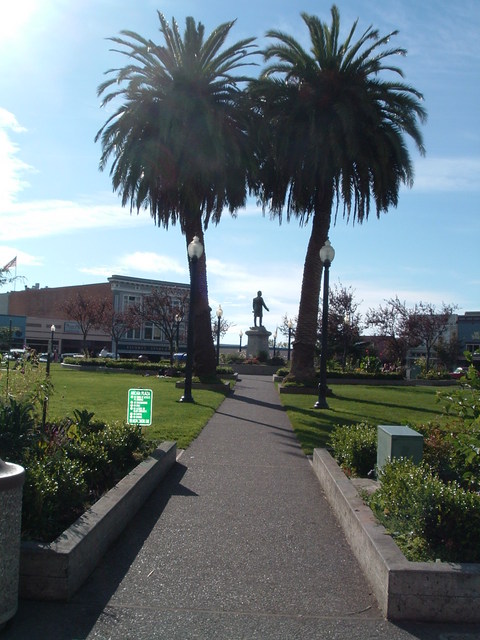
**Note: I didn't take this picture (it's from the Internet). But I can attest to palm trees being in the downtown Plaza.

Miles biked: 0 (934.7 overall)

I awakened Friday morning with no specific agenda in mind. There were a few things I needed to do in preparation for three days of hiking with Dad -- buy crappy tennis shoes, do laundry, ask Marnin about camping spot for Saturday night -- but nothing that would take up most of the day or night.

(Except, of course, blogging the trip and uploading pictures.)

Anyway, I rode downtown early in the morning to drop the 520 off at a small bike shop. Especially since I'm no cycling expert, I wanted to get the bike a mid-trip tuneup to ensure it won't start breaking into pieces as I'm riding along the Pacific Coast Highway, 300 feet above the Pacific with no guardrail.

So I dropped the bike off and then did some exploring by foot.

And it didn't take me long to fall in love with Arcata.

It's a small town, with my bike map listing a population of 16,651, but it certainly doesn't feel like a boring place. It has the eclectic feel of a town where there's always something interesting happening.

As Marnin pointed out, Humboldt State University is a big part of the town. The Division II school has an enrollment of 8,500 and sits just northeast of downtown and The Plaza, where most of the bars and popular shops are.

The coolest thing I noticed from walking around is that all the stores, from shoe stores to pizza joints, are locally owned. Marnin later explained that an ordinance was passed a few years ago that prohibited chain stores from eating up any of the downtown space.

If only every town did something similar.

Because tell me if this happens in your typical Foot Locker...

As mentioned, I needed shoes for hiking, so I walked into a local place on G Street. I didn't want to pay more than roughly $40, but everything I saw on the shelves was $54.99 or up.

The one guy in the place, though, was clearly one of the owners and helped me stay within my budget. When I explained my situation, he brought out three pairs of adidas -- decent shoes, really -- that he offered to me for $40 each. He even brought out a pair of Nike's, a pair that felt like $80 shoes, and offered them for $50.

We chatted for about 13 minutes, talking mostly about the university and its sports teams -- according to the guy, the hoops team is good every year and attracts lots of local attention -- and I walked out of the store with a pair of $40 shoes (only after he let me use his private bathroom).

I felt better after the experience, and I felt full a while later following a large, and, not to be forgotten, cheap lunch at a local Mexican spot.

I also briefly explored the Redwoods, which are on the east side of town in a city park.

With a university, a forest, Humboldt Bay -- which I didn't make it to -- and, let's not forget, the ocean just minutes away, Arcata seems like a great town.

And, I should mention, a health-oriented place.

There are natural food stores all over the downtown, even more than I know of in much bigger Ann Arbor. And there are restaurants aimed at Vegetarians, soup lovers and organic-food enthusiasts.

I could definitely see myself in such a place.

I'll add it to my growing list of Western cities I've quickly fallen in love with...

But I'll leave it Saturday morning to pick up a rental car from the airport, with which I'll pick up Dad at night and prepare for three full days of hiking in the Redwoods, Trinity Alps and possibly the Mt. Shasta area.

Stay tuned for my hiking tales (and for sure-to-be beautiful pictures from them).

And be sure to check out all my other pictures, which are posted at: http://picasaweb.google.com/jakeblloyd